This is a 24 hour Early access release for all paying patreons
Subtitles available!
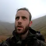
For my 9th straight line mission, I've gone old school. Instead of a GPS system I'll be following nothing but an Ordnance survey map. I won't even be using a compass (because I forgot it).
The task is to cross the spine of England; the Pennines, starting from Meltham, Yorkshire in the East and ending 6.5 miles away in Upper Mill, Greater Manchester. On the way I'll traverse farmland, mountains and ravines and a whole load of barren, featureless moorland.
The question is, will I be able to stay anywhere near the line in these places, using only the information on my map?
james dollard
2025-04-06 19:26:44 +0000 UTCGerne Hareth
2025-04-04 22:55:15 +0000 UTC